
Compared to the earlier years of human existence where people just traveled roads the way they were, we now have modernized versions for cars and every other kind of vehicle.
There are seven continents in the world which include North America, South America, Antarctica, Europe, Africa, Asia, and Australia/Oceania.
Looking to learn fascinating facts about the continent you live in? This piece covers the longest roads across these continents listed above. Read on to learn more:
Asia

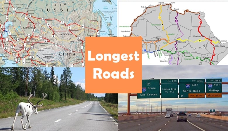
Asian Highway Network – Map of the highways
Link
- Asian Highway Network
Asia and Europe, together with the United Nations Economic and Social Commission for Asia and the Pacific (ESCAP), are working together to upgrade Asia’s highway infrastructure via the Asian Highway Network (AH), commonly known as the Great Asian Highway.
Since it was approved in 1992, it has served as an important component in Asia’s Land Transportation Infrastructure Development (ALTID) project, which includes Asian Highway, Trans-Asian Railway (TAR), and facilitation of land transportation projects.
The Asian Highway Network has plenty of routes with the longest being the AH1 with a length of 20,557 kilometers (12773.52 miles).
- China National Highway 219
Guódào219 is a highway that runs from Kom-Kanas in Xinjiang to Dongxing in Guangxi, forming part of China’s whole western and southern border with Mongolian ethnicity.
It is the longest highway in China at over 10,000 kilometers (6214 miles). After completion, it became the country’s longest National Highway and will be part of China’s National Highway Network Planning (2013–2030).
The G219 bridge linked the Xinjiang Uyghur Autonomous Region with the Tibet Autonomous Region at Yecheng in the years before 2013. (Karghilik). It had a total length of 2,342 kilometers (1,455 miles).
Africa

Map of Trans-African Highways based on data 2000 to 2003
By I, Rexparry sydney, CC BY-SA 3.0, Link
- Trans-African Highway
It is being developed by the African Development Bank, the African Union, and the United Nations Economic Commission for Africa (UNECA) with assistance from other international entities.
Improving highway infrastructure and managing road-based trade routes in Africa is a priority for them. The network’s nine highways total 56,683 km (35,221 miles).
Trans-African Corridors or Road Corridors are sometimes used instead of freeways.
Heard it’s the world’s longest “motorable road”? However, the Darién Gap prevents a route from connecting South and Central America. Only land connects the final Colombian settlement to the first Panamanian town.
A four-day walk through one of the world’s wettest areas is required.
Europe

E45 between Sorsele and Slagnäs in Lappland, Sweden. The speed limit here has been reduced to 100 km/h (62 mph)[1] from 110 km/h (68 mph) since this picture was taken.
Link
- European Route E40
The longest European route is the E 40, which runs from Calais in France to Ridder in Kazakhstan near the borders of Russia and China. It is more than 8,000 kilometers (4,971 miles) long and connects Belgium to Germany to Poland to Ukraine to Russia to Kazakhstan to Kyrgyzstan.
A different way to get from Calais to Ridder is about 2,000 kilometers (1,243 miles) shorter, mostly by taking the E30 through Berlin, Moscow, and Omsk.
Because the E40 is different from that route, it gives more direct east-west access to Uzbekistan, Turkmenistan, and Kyrgyzstan, which together have a population of 50 million people by 2021.
- European Route E45
The European route E45 connects Norway and Italy, passing through Finland, Sweden, Denmark, Germany, and Austria.
It is the longest road in Europe. With a length of about 5,190 kilometers (3,225 miles), it is the longest north-south European route (although some east-west routes are longer than others).
North America and South America

Interstate 25 (Pan-American Freeway) approaching the Big I interchange in Albuquerque, New Mexico, USA.
CC BY-SA 2.0, Link
- Pan American Highway
There are about 30,000 kilometers (19,000 miles) of roadways that make up the network known as the Pan-American Highway.
Except for the Darién Gap, a 106-kilometer (66-mile) stretch of jungle separating southeast Panama from northwest Colombia, the Americas’ Pacific coastline nations are all linked by roadways.
The Pan-American Highway is the world’s longest “motorable road,” as determined by Guinness World Records.
The Darién Gap, on the other hand, prevents a route from connecting South and Central America. T
o traverse the border between South and Central America by land, one must travel for at least four days through one of the world’s rainiest regions.
- US Route 20
The United States Route 20 (US 20) runs from the Pacific Northwest to New England. Since US 20 is a significant coast-to-coast road, its route number is “0.” It is 3,365 miles (5,415 km) long and runs almost parallel to the modern Interstate 90 (I-90), which is also 3,365 miles (5,415 km) long.
Unnumbered roads cross Yellowstone National Park, interrupting the official designation of US 20.
Australia
- Australian Highway 1
_map.png#/media/File:Highway_1_(Australia)_map.png)
Map of Highway 1, which is a ring road around Australia.
CC BY-SA 3.0, Link
Highway 1 in Australia is a network of roadways that circumnavigates the nation, connecting all mainland state capitals as well as the city of Darwin.
With a total length of around 14,500 kilometers (9,000 miles), it is the world’s longest national roadway, exceeding both the Trans-Siberian Highway (over 11,000 kilometers or 6,800 kilometers) and the Trans-Canada Highway (over 11,000 kilometers or 6,800 kilometers) (8,030 km or 4,990 miles).
Every day, more than a million people use some portion of the nation’s roadway system.
Antarctica

A red line indicating the path of the traverse
CC BY-SA 2.5, Link
- South Pole Traverse
This route, also known as the South Pole Overland Traverse, connects the coast of Antarctica’s McMurdo Station with the Amundsen–Scott South Pole Station, which is both operated by the National Science Foundation of the United States.
It is approximately 1,601 km (995 miles) long and is flagged by the National Science Foundation of the United States.
It was built by leveling snow and filling in crevasses, and flags indicate its course from McMurdo Station over the Ross Ice Shelf to the Leverett Glacier, where it ascends to the polar plateau and on to the South Pole. It was made by leveling snow and filling in crevasses.
The dimension of stuff has been an interest of mine ever since I was a child. What I believe is most fascinating about the dimension of stuff is how extremely long, tall and wide some objects are both on earth and in the universe.